High Atltitude Ballooning
Project Status: 100%
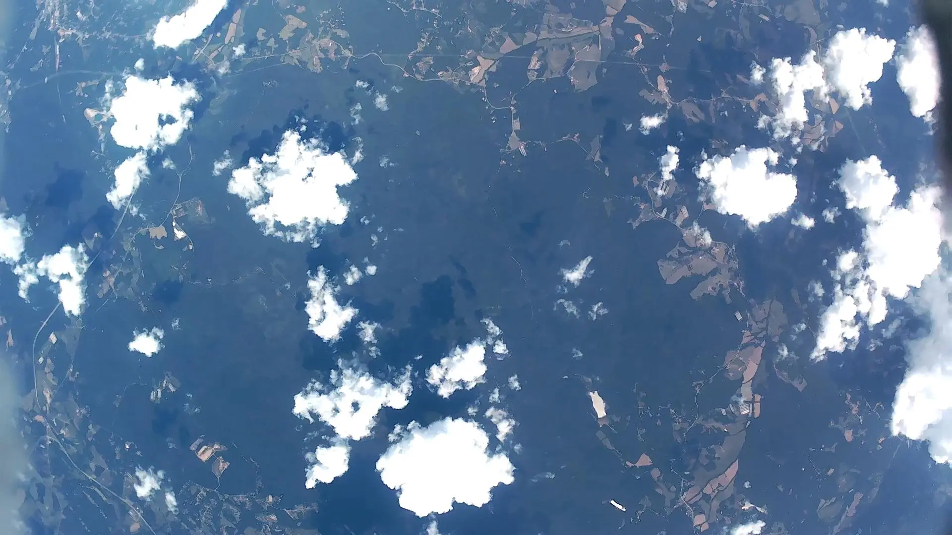
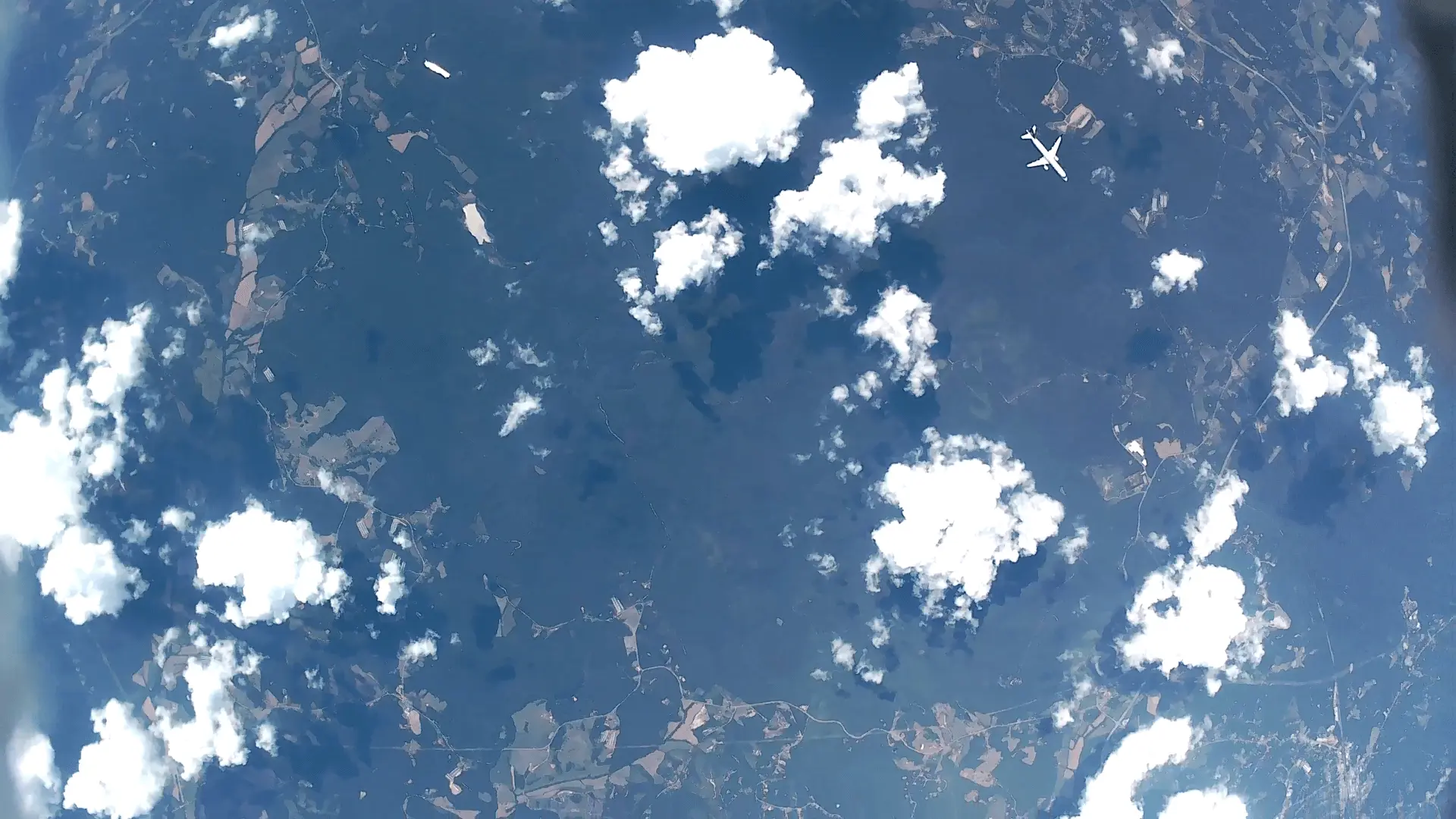
This is a little scientific experiment I’ve been meaning to pull off for awhile now. Overall it went well, an altitude near 80,000 feet was reached, my flight planning was dead accurate, and I recovered my payload with a little assistance but I did make my fair share of mistakes for a v1 :). I got a nice little visit from a plane before my cameras cut out…
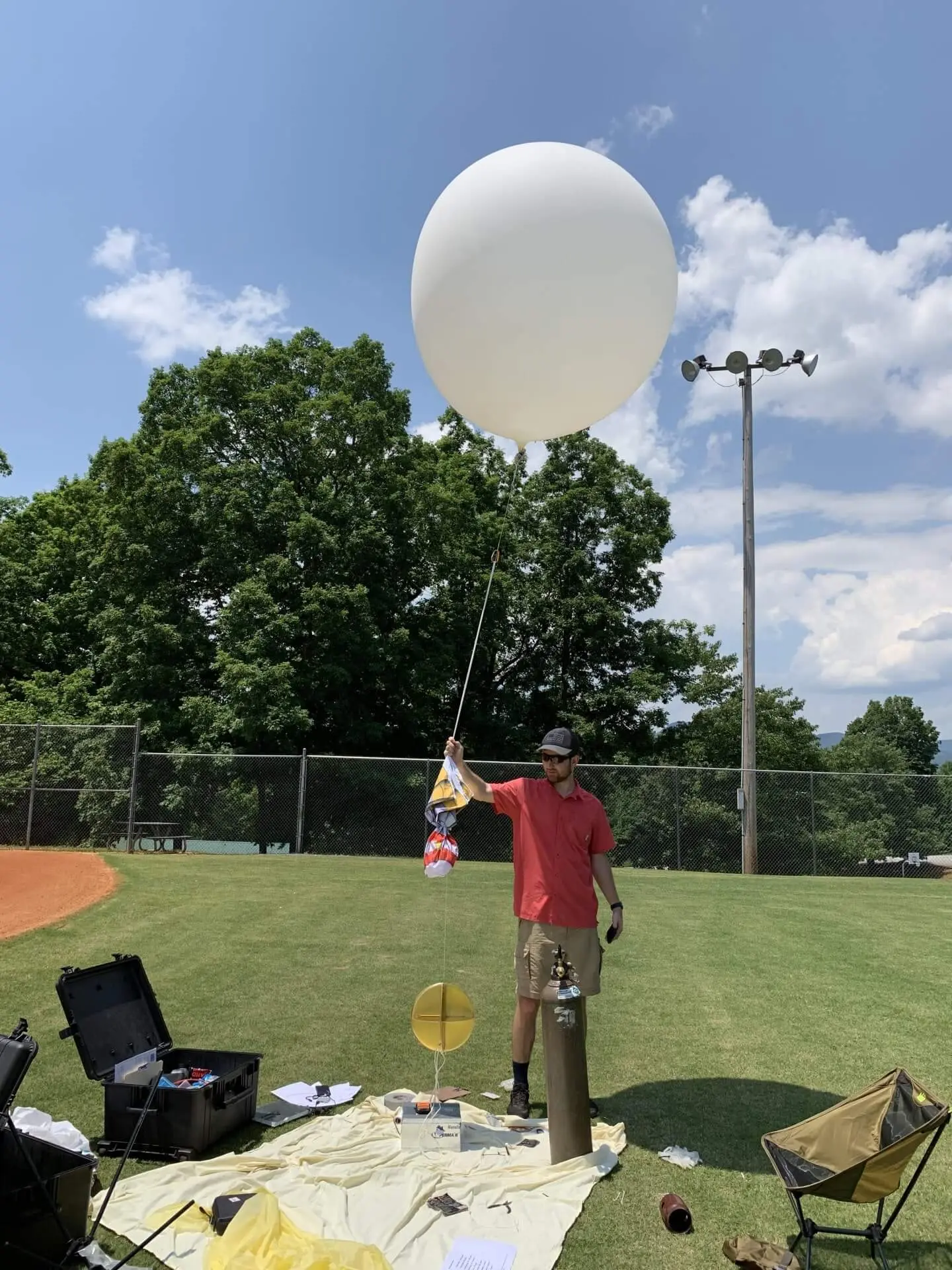
Takeoff
Launching involved overcoming quite a few of last minute challenges, but fortunately I finally achieved the ascent rate I planned around.
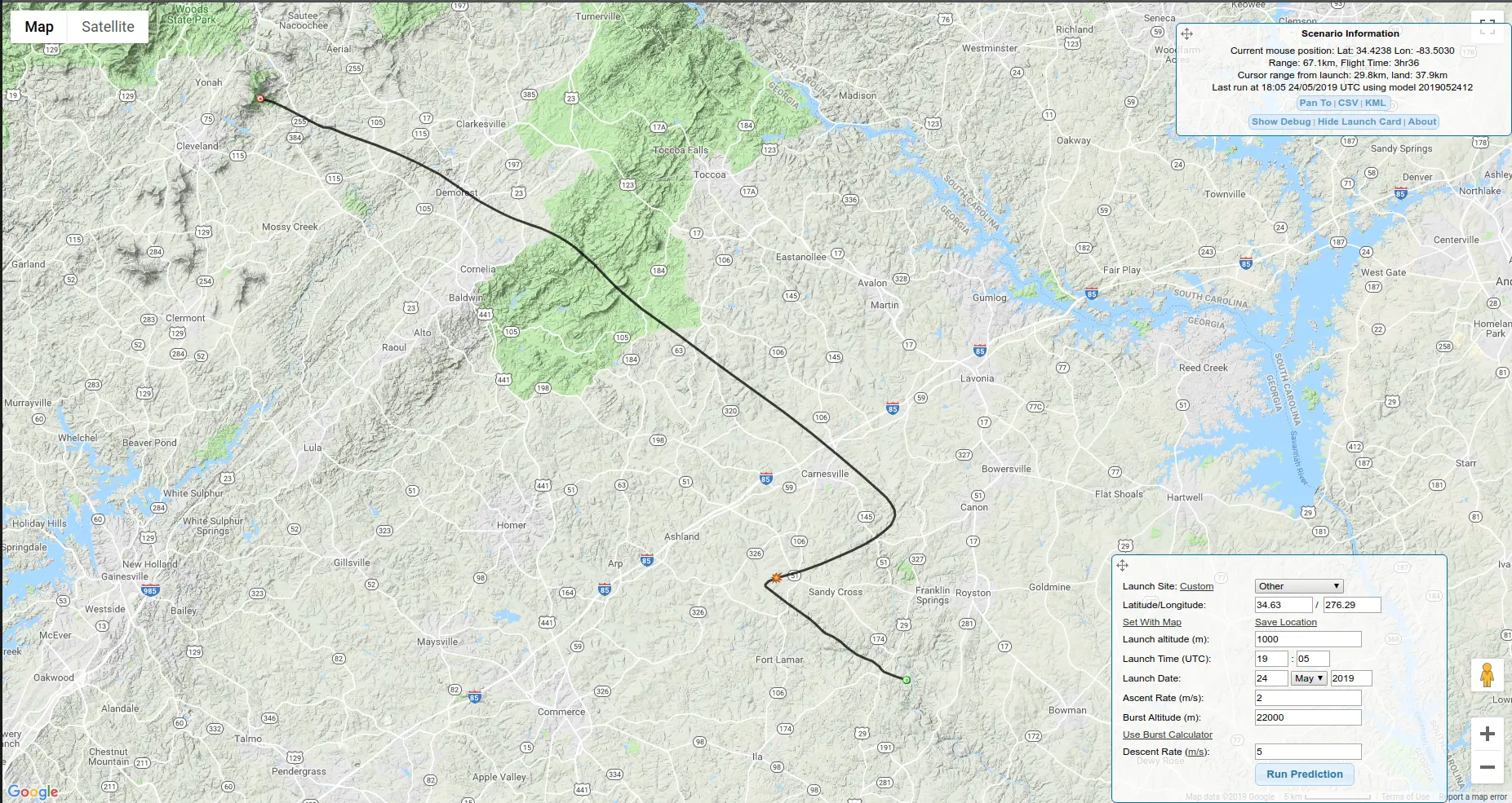
Tracking
One of the most difficult parts of the planning and operations phases is the tracking of the balloon. It is critical to avoid major airports and large bodies of water. I choose to launch from Yonah Mountain due to the weather patterns I saw over the course of several weeks and the distance from Hartsfield Jackson. I used several online predictors such as the one shown below as well as a few simple calculations to check, and wouldn’t you know it the balloon flew almost precisely as predicted.
![]()
![]()
![]()
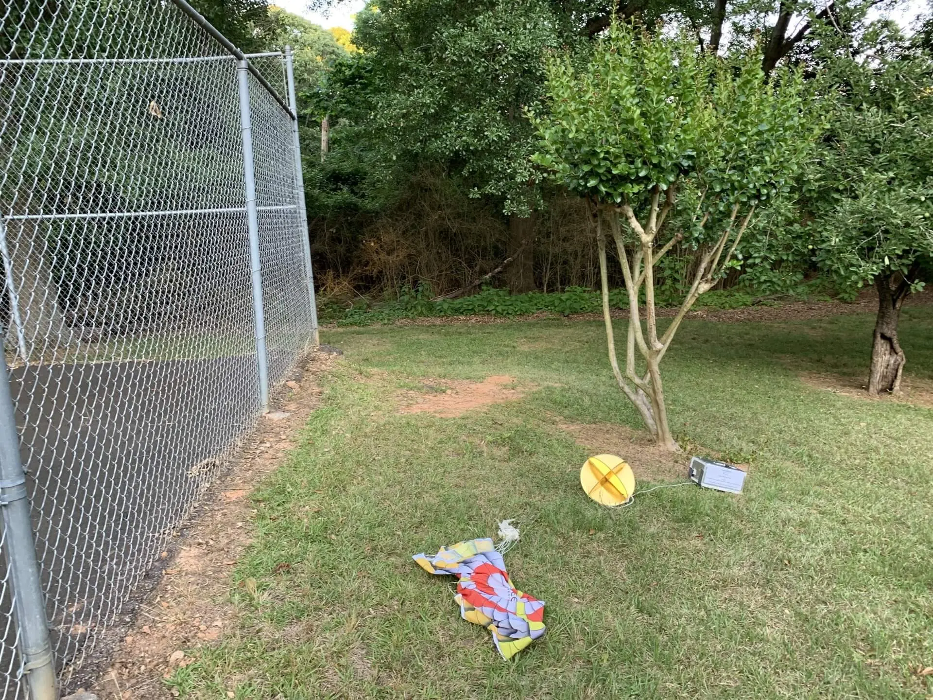
Landing
While searching for hours, we did not find the balloon on the launch day due to the GPS landing upside down. As luck would have it, the balloon landed on the property of an extremely kind individual who followed the instructions I had taped to the side. One more long drive later and I had my equipment back.
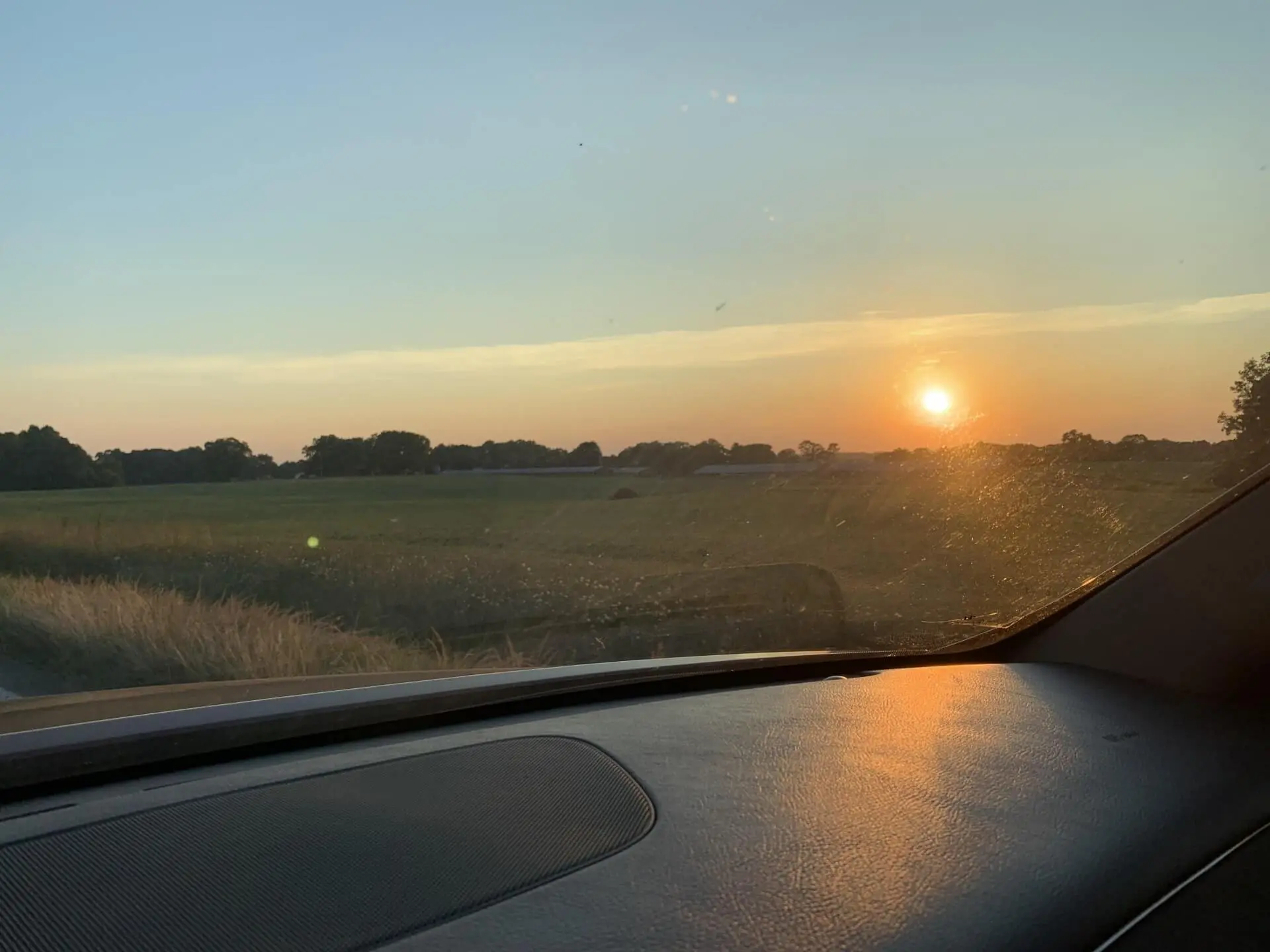
It was a lot of driving, but I’m glad I got to see some of the more beautiful parts of rural Georgia.
Flight Images
Given a weight problem, I had to remove a battery that would have sustained the cameras for much longer but fortunately I did get quite a bit of 4k footage from high altitudes, including a plane crossing underneath the balloon.
Downward View
Side View

Plane Crossing
Useful Sites
- http://tools.highaltitudescience.com/#
- https://www.rocketreviews.com/index.php
- http://habhub.org/calc/
- https://www.overlookhorizon.com/flight-safety/
- http://predict.habhub.org/#!/uuid=006cfec684ca53cfc675111274af1b9cd764676b
- https://community.balloonchallenge.org/t/flight-prediction-overview/672
- https://www.wolframalpha.com/input/?i=953.135*e%5E(-0.00103x)+at+3000
- https://login.findmespot.com/spot-main-web/auth/login.html